

I've started working on a project to map and identify the 14 rock piles that make up the Alki Fishing Reef in West Seattle.
The reef is a pretty interesting dive site, but navigating between the piles can be difficult. After about a 13-minute scooter ride from the north, you arrive at the reef. The piles are spread out enough that you generally can't see the next one from where you're sitting.
My idea is to install a permanent dive slate on each of the 14 piles. Each slate will have a bathymetric map of the reef showing all the rock piles, with a large "You Are Here" marker identifying your current location. Eventually, the slates will also include compass headings, distances to nearby piles, and coordinates.
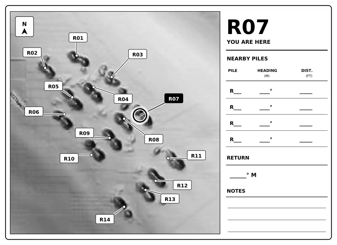
I've been working with existing bathymetry of the area to identify and number each pile. So far, I've created 14 individual slate designs using the same map, with each one identifying its corresponding pile. The slates are designed to be printed on white plastic with black lettering.
The next step is getting underwater and checking the maps against the actual reef. I'll be taking the slates down to verify the pile locations, make corrections, and collect compass headings and distances between them. Once everything checks out, I'll have the final versions printed for permanent installation.
Besides making navigation easier, I'd like this to become a useful reference for divers visiting the reef. If someone finds an octopus, an interesting piece of marine life, or something worth photographing, they can identify exactly which pile they were on rather than trying to describe where they were.
It's still an ongoing project, but I have the first set of 14 maps ready to start testing.